دوست عزیز، به سایت علمی نخبگان جوان خوش آمدید

مشاهده این پیام به این معنی است که شما در سایت عضو نیستید، لطفا در صورت تمایل جهت عضویت در سایت علمی نخبگان جوان اینجا کلیک کنید.

توجه داشته باشید، در صورتی که عضو سایت نباشید نمی توانید از تمامی امکانات و خدمات سایت استفاده کنید.
صفحه 1 از 3 123 آخرینآخرین
نمایش نتایج: از شماره 1 تا 10 , از مجموع 23

موضوع: دانلود نرم افزارهای تخصصی مهندسی راه و ترافیک

  1. #1
    کاربر اخراج شده
    رشته تحصیلی
    مهندسی عمران
    نوشته ها
    0
    ارسال تشکر
    11,136
    دریافت تشکر: 25,270
    قدرت امتیاز دهی
    0
    Array
    M@hdi42's: لبخند

    smilee1 دانلود نرم افزارهای تخصصی مهندسی راه و ترافیک

    جهت نظم دهی بهتر نرم افزارهای دانلودی و دسترسی بهتر نرم افزارهای مرتبط به بخش مهندسی راه و راه آهن یا مهندسی ترافیک در این تاپیک قرار داده میشود.
    قبل از این تاریخ نرم افزارهای دیگری به صورت متفرقه در این زمینه قرار داده شده است که به دلیل تعدد آنها لینک دهی به همه آنها در این تاپیک امکان پذیر نباشد.
    از کاربران نیز تقاضا میشود این نرم افزارها را فقط در این تاپیک برای دانلود معرفی نمایند


    - - - به روز رسانی شده - - -

    برخی از نرم افزارهای مرتبط که قبلاً در انجمنهای سایت لینک داده شده اند:
    نرم افزار طراحی راه (Roadware)
    http://iransaze.com/ftopict-5279.html

    نرم افزار تحلیل و طراحی روسازی های نرم و سخت
    http://iransaze.com/ftopict-16678.html

    دانلود نرم افزار ایرانی راهسازی تحت داس MASSIR
    http://iransaze.com/ftopict-16637.html

    دانلود نرم افزار Vehicle Path همراه با کرک
    http://iransaze.com/ftopict-16661-.html%2Aroad%2A

    نرم افزار راهسازی راهکار
    http://iransaze.com/ftopict-5322-.html%2Aroad%2A


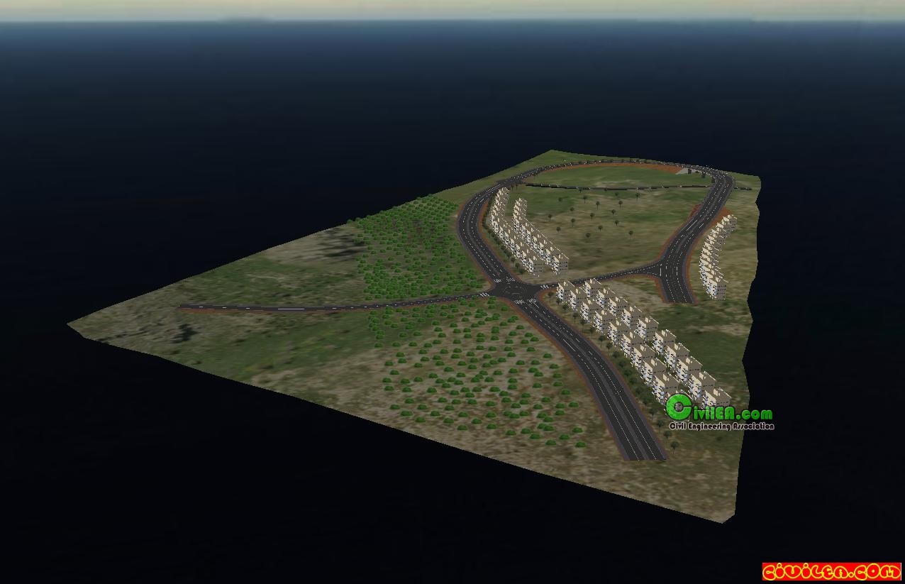
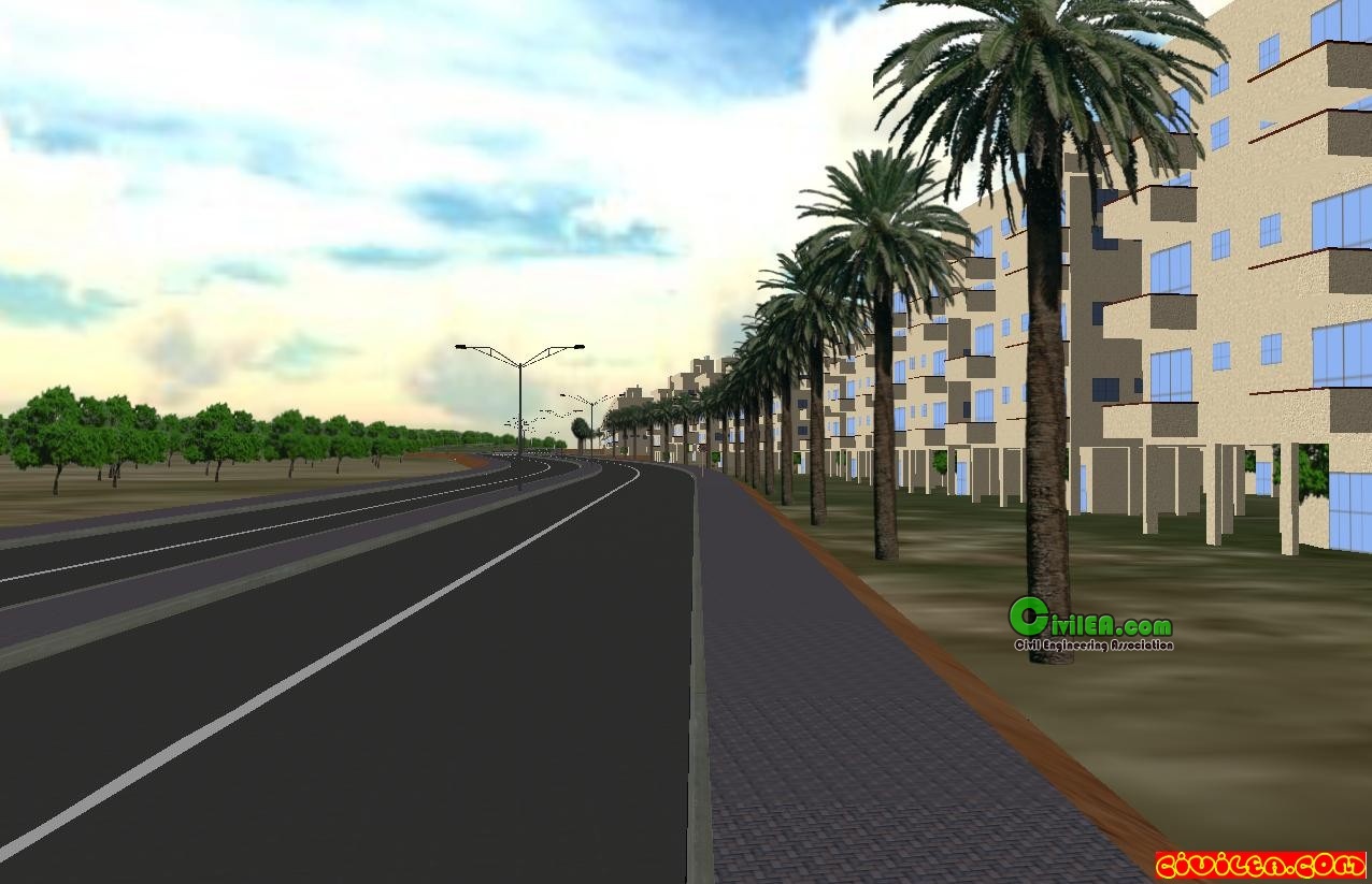
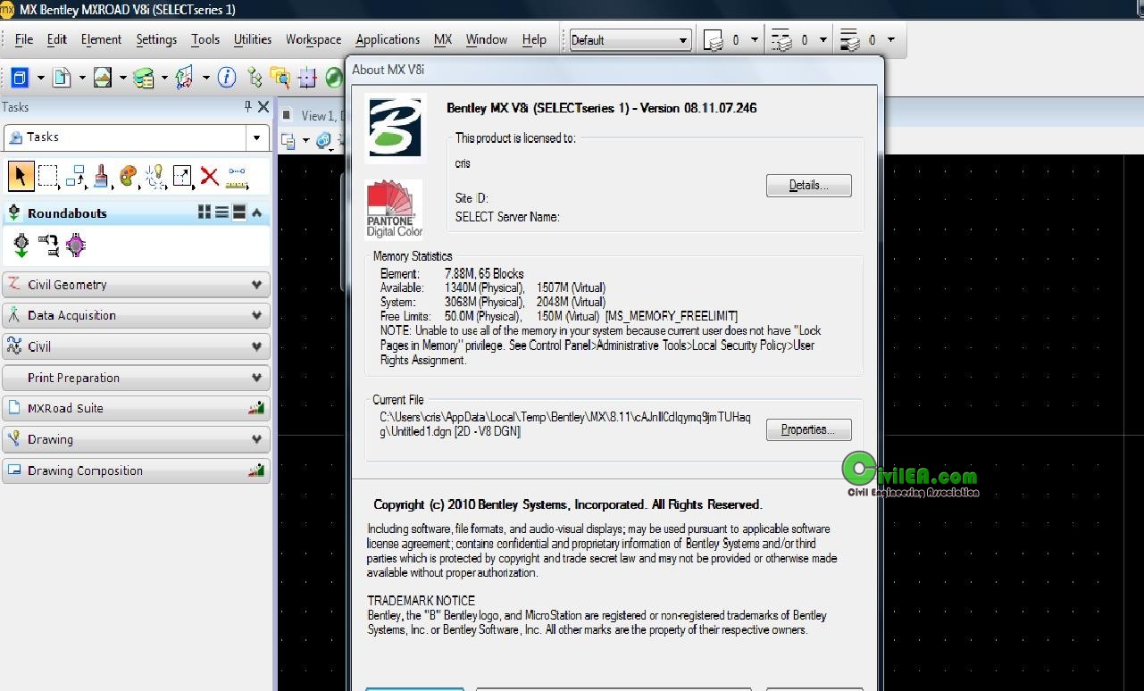
    دانلود نرم افزار Bentley InRoads Suite v8i.XM.v8.11.05.47 (+ Civil Extension )
    http://iransaze.com/ftopict-10636-.html*road*

    دانلود برنامه صورت وضعیت رشته راه ، باند فرودگاه و زیرسازی راه آهن 1387 تحت اکسل
    http://iransaze.com/ftopict-13806-.h...B1%D8%A7%D9%87

    برنامه kenlayer برای حل مسایل درس روسازی بر اساس آیین نامه AASHTO
    http://iransaze.com/ftopict-12855-.h...B1%D8%A7%D9%87

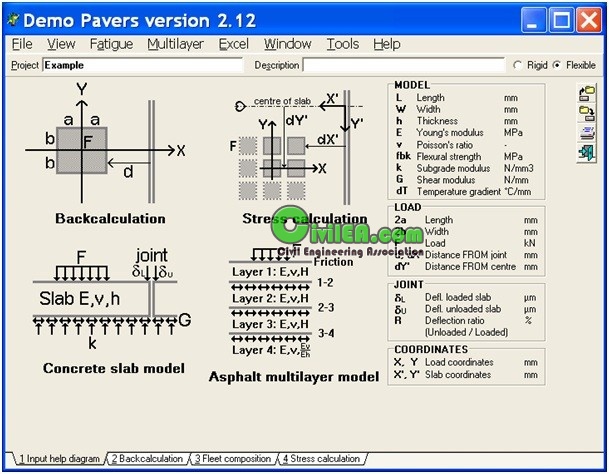
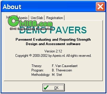
    دانلود نرم افزار micro paver - نرم افزاری برای مدیریت و نگهداری روسا زی راه و تحلیل چرخه
    http://iransaze.com/ftopict-9985-.ht...B1%D8%A7%D9%87

    راه افزار برنامه اي براي پروژه هاي راه سازي
    http://iransaze.com/ftopict-6718-.ht...B1%D8%A7%D9%87

    برنامه طراحی قوس کلوتوئید
    http://iransaze.com/ftopict-3586-.ht...B1%D8%A7%D9%87

    دانلود برنامه طراحی قوس دایره ای ساده
    http://iransaze.com/ftopict-1776-.ht...B1%D8%A7%D9%87


    3D Railroad Concept and Design 2.0.3 Full
    http://iransaze.com/ftopict-7930-.html%2Aroad%2A

    دانلود نرم افزار geo-slope
    http://iransaze.com/ftopict-5853-.html%2Aroad%2A

    GGU Gabion v2.11 - Calculation of Gabion Walls
    http://iransaze.com/ftopict-810-.html%2Aroad%2A

    دانلود کنید 3D Railroad Concept and Design 2.0.3 Full
    http://iransaze.com/ftopicp-31703.html#31703


  2. کاربرانی که از پست مفید M@hdi42 سپاس کرده اند.


  3. #2
    کاربر اخراج شده
    رشته تحصیلی
    مهندسی عمران
    نوشته ها
    0
    ارسال تشکر
    11,136
    دریافت تشکر: 25,270
    قدرت امتیاز دهی
    0
    Array
    M@hdi42's: لبخند

    پیش فرض پاسخ : دانلود نرم افزارهای تخصصی مهندسی راه و ترافیک

    دانلود نرم افزار BISAR 3.0
    منبع
    The Windows computer program BISAR 3.0 replaces the DOS version BISAR-PC 2.0. The program is suitable for Windows 3.1, Windows 95 and Windows NT.

    With the release of BISAR 3.0 the full possibilities of the original mainframe BISAR computer program are now available for use in the Windows environment. In addition to the calculation of stresses and strains BISAR 3.0 is capable of calculating deflections and is able to deal with horizontal forces and slip between the pavement layers. This offers the opportunity to calculate comprehensive stress and strain profiles throughout the structure for a variety of loading patterns, including air-crafts. In this way, BISAR 3.0 package is a valuable calculation tool, which can be used for refining the SPDM 3.0 designs, to carry out more complicated designs (e.g. for cement-bounded base layers or airport designs) and as a stand-alone program for theoretical calculations on elastic multi-layer systems

    لینک دانلود:
    http://www.megaupload.com/?d=EOZFC2YK
    or
    http://www.mediafire.com/?02ydzzomddz


    - - - به روز رسانی شده - - -


    PAVERS 2.12 Advanced Tool for Pavement Design DEMO
    http://forum.civilea.com/Thread-pave...56011#pid56011

    Pavers ® brings new efficiencies to the complex and demanding task of road, airport and industrial pavement design, construction, evaluation, and maintenance. The tool allows to back-calculate FWD-deflections, model the pavement structure, (re-)design the pavement, determine the load-carrying capacity (in terms of ACN/PCN), calculate the remaining pavement life and determine feasible rehabilitation measures.
    It is a complete software package that allows the modern pavement engineer to define or use calibrated performance models and failure criteria for all pavement layers and subgrade in his pavement design and H/FWD assessment projects. Hence, the effect of different pavement materials, strengths, load or complex load mixes can quickly be explored. Read more about the origin of Pavers ®.

    ———————————————— ————

    It is only demo version.
    Windows Vista users: Install and run under Windows XP Mode.
    بند انگشتی, برای دیدن عکس به صورت کامل بر روی آن کلیک نمایید


    http://www.pavers.nl/

    http://ifile.it/90oahje/PAVERS%202.12%20DEMO.rar

  4. #3
    کاربر اخراج شده
    رشته تحصیلی
    مهندسی عمران
    نوشته ها
    0
    ارسال تشکر
    11,136
    دریافت تشکر: 25,270
    قدرت امتیاز دهی
    0
    Array
    M@hdi42's: لبخند

    پیش فرض پاسخ : دانلود نرم افزارهای تخصصی مهندسی راه و ترافیک


    Advanced Road Design 2011 (x32 and x64)
    http://forum.civilea.com/Thread-adva...-design--23164
    Advanced Road Design (ARD) has been developed to provide Australian based road and drainage design and outputs inside AutoCAD Civil 3D. Built for the AutoCAD Civil 3D design environment, ARD features a streamlined design interface to merge seamlessly with AutoCAD Civil 3D and work with the Civil 3D civil objects. Centralised design tools make it easy for you to edit any design element without having to search through multiple commands or run sequential routines.


    Road Design
    With the ARD Vertical Design Windows you get complete access to any selected design element including editing the vertical design and cross sections, establish cut/fill bulking factors, generate summary volume reports and create surface models of your designs.

    Drainage Design
    Simple to use layout and editing tools are included so you can create and adjust your pits and pipes as required. Creating pits and pipes is made easy with options to click on screen or create directly from polylines and alignments.
    Easily create drainage catchments directly from the digital terrain in Civil 3D and a polyline – catchment style libraries allow you to easily assign catchment criteria for common catchment types.
    When a network is created the design flows are calculated and pipe sizes and levels are automatically assigned to manage the flows as well as minimum cover, slope and flow velocities.

    Pipe Design
    Create and layout your sewer network by either clicking on screen or create directly from polylines or alignments. Whilst the initial pipe layout is based on minimum slopes and covers, the multiple Vertical Design Windows allow you to quickly adjust any pipe sizes and levels to achieve your desired outcomes.

    Sewer Design
    Create and layout your sewer network by either clicking on screen or create directly from polylines or alignments. Editing tools match those in the drainage module to enable you to readily change pipe and pit properties.
    Sewer house/property connections are included to check for depth controls and minimum levels along the sewer network. Each house connection can be viewed in a Vertical Design window for editing and adjustment.
    The sewer network will automatically adjust to ensure compliance with the minimum house connection levels, and the user will be alerted as sewer pipe edits result in any compliance issues with house/property connections.


    Install standalone, Comercial.
    Run RLM.EXE, Allow access in Firewall amd leave it open.
    The license and the other two files have to be together in one folder.
    Tested in Windows 7 64 bit and using Civil 3D 64 bit.
    I can't tell more about resultats because this is not my speciality and i don't use Civil 3D.
    بند انگشتی, برای دیدن عکس به صورت کامل بر روی آن کلیک نمایید

    http://hotfile.com/dl/109657022/0bc9...11-64.rar.html
    http://hotfile.com/dl/109685774/5312...11-32.rar.html
    PASSWORD: FromCivilEA

  5. #4
    کاربر اخراج شده
    رشته تحصیلی
    مهندسی عمران
    نوشته ها
    0
    ارسال تشکر
    11,136
    دریافت تشکر: 25,270
    قدرت امتیاز دهی
    0
    Array
    M@hdi42's: لبخند

    پیش فرض پاسخ : دانلود نرم افزارهای تخصصی مهندسی راه و ترافیک


    Sivandesign Civil Simulate
    http://forum.civilea.com/Thread-civil-simulate
    The use of 3D visualizations and simulations, both available in Civil Simulate, are techniques used in planning, design and presentation of road design anf construction projects.
    Visualization – provides realistic 3D representation of what the project will look like from an unlimited number of different viewing angles.
    Simulation – adds interactive drive-through capabilities to the visualization, allowing the user or an audience to experience how driving the road would be like from the driver’s point of view.

    Civil Simulate is able to transform any AutoCAD® Civil 3D® or CivilCAD project into a lifelike 3D environment, allowing navigable drive through simulation, literally with a single mouse click.
    By simply clicking the "Simulate" button, Civil Simulate parses raw data from within the drawing to construct an extremely accurate 3D model. Civil Simulate independently interprets defined junctions, intersections, roundabouts, and bridges based on project specific parameters. Using an integrated menu within Civil 3D or CivilCAD the designer can easily access simulation properties to define additional parameters.

    When you install Civil Simulate, it gives you an additional menu called Simulate in your Civil 3D toolbar. This menu allows you to instantly turn your Civil 3D project into what looks like a 3D video game environment, complete with texture and weather. It should be noted that the weather simulation (snow, rain, and clouds, for instance) is an atmospheric touch, not an accurate rendering based on real-world weather reports of the project site. On the other hand, the virtual terrain is supposedly accurate within 2 cm of the CAD data.

    YOu can download a 30 days trial version from
    www.sivandesign.com
    (need email for receiving).
    Use the posted utility for renewing the 30 days. When 30 days expired, uninstall, run my utility and install again for 30 days.

    The first image is the Autocad drawing, the second the simulation and the third one scene from driving path.
    After installing you can found in samples folder some cvu files to play.
    بند انگشتی, برای دیدن عکس به صورت کامل بر روی آن کلیک نمایید

    بند انگشتی, برای دیدن عکس به صورت کامل بر روی آن کلیک نمایید

    بند انگشتی, برای دیدن عکس به صورت کامل بر روی آن کلیک نمایید

    http://rapidshare.com/files/306937462/Sim30.rar.html
    password:
    FromCivilEA
    you can download trial version from
    http://www.sivandesign.com/Software/...lSimulate2.exe

  6. #5
    کاربر اخراج شده
    رشته تحصیلی
    مهندسی عمران
    نوشته ها
    0
    ارسال تشکر
    11,136
    دریافت تشکر: 25,270
    قدرت امتیاز دهی
    0
    Array
    M@hdi42's: لبخند

    پیش فرض پاسخ : دانلود نرم افزارهای تخصصی مهندسی راه و ترافیک


    Bentley MXroad V8i (SELECTseries 1) - 30 DAY TRIAL
    http://forum.civilea.com/Thread-bent...8i-selectserie
    Size: 620.74 MB
    بند انگشتی, برای دیدن عکس به صورت کامل بر روی آن کلیک نمایید

    Bentley MXROAD is an advanced, string-based modeling tool that enables the rapid and accurate design of all road types. With MXROAD you can quickly create design alternatives to achieve the “ideal” road system. Upon selection of the final design alternative, MXROAD automates much of the design detailing process, saving the user time and money.
    What’s enhanced in MXROAD and MXROAD Suite V8i (SELECT series 1)?

    Roadway Designer Scheme manager for MX
    Dynamic Surface Analysis caters for multiple MX models and boundary control. Utilizing Civil DTM technology changes to the design can be visualized quickly/dynamically without the need to run MX analysis/display options.
    AutoCAD 2010 is now a supported environment to run MX. Bringing the supported AutoCAD versions to 2007, 2008, 2009, 2010
    Enhanced menus and GUI customization using MicroStation Tasks and toolbars, providing fully customizable MX toolbars in the standalone and MicroStation environments
    Reference file management now supported through input files via the MX script manager
    Dynamic Section Enhancements
    MX specific improvements to Accudraw
    Incorporation of Bonus tools
    Display Styleset - providing the ability to graphically test all features in a style set
    Extend a String - providing the ability to extend a string to a string or a point or by distance and calculate the level
    Support added for LandXML 1.2 schema
    MX Engine Enhancements
    Command Macros now enhanced to allow arithmetic between two or three variables
    Use of different macro lines to display Interface strings
    Interface now honors the String Naming Convention on Repeat Patterns, Rounding, and Circular Ditches
    Drainage Design Enhancements
    More than one pipe between two nodes
    Display surface flow to upstream inlet
    Automatic inlet spacing – general improvements for:
    Inlet rules files now support efficiency
    Support for combined curb and drainage systems


    30 day trial

    ftp://ftp2.bentley.com/dist2/intel/v...07246en_gb.exe

  7. #6
    کاربر اخراج شده
    رشته تحصیلی
    مهندسی عمران
    نوشته ها
    0
    ارسال تشکر
    11,136
    دریافت تشکر: 25,270
    قدرت امتیاز دهی
    0
    Array
    M@hdi42's: لبخند

    پیش فرض پاسخ : دانلود نرم افزارهای تخصصی مهندسی راه و ترافیک


    Bentley InRoads Suite v8i XM.v8.11.05.47 - PC Win
    http://forum.civilea.com/Thread-bentley-inroads-suite
    Bentley InRoads Suite v8i XM.v8.11.05.47 - PC Win
    Win App | 115mb | RS,UPL,Hotfile

    The Bentley InRoads family of civil engineering products is the central design solution on many major civil engineering and transportation projects. InRoads offers consistent, discipline-specific design functionality on your choice of AEC platform: MicroStation or AutoCAD (2007 - 2009).


    Powerful and versatile, InRoads applications can be used to address a broad array of project needs, from rapid evaluation of impacts during preliminary phases to final design and plans production. They are particularly suited to multi-modal design and situations with complex transitions and curves.

    Powerful regression analysis combined with the unique element design capability of InRoads gives users the power to resolve complex design geometry efficiently and accurately in accordance with unique engineering design criteria. A unique roadway designer allows interactive design and review in a synchronized viewing environment.

    Along with roads and highways, InRoads applications are put to use on a host of engineering projects, including railways, municipal and public works projects, commercial and industrial sites, levees, canals and rivers, pipelines, environmental projects and more. Users can improve productivity and accuracy with focused yet integrated applications.

    + InRoads
    + InRoads Bridge
    + InRoads Site
    + InRoads Storm & Sanitary
    + InRoads Survey

    More Info:
    Code:
    http://www.bentley.com/en-US/Products/InRoads+Suite/

    Download Links (Interchangeable) :
    Code:
    http://uploading.com/files/YKBTNTTK/...part1.rar.html
    http://uploading.com/files/OP72YLMR/...part2.rar.html
    http://uploading.com/files/3XNOHR93/...part3.rar.html
    Code:
    http://rapidshare.com/files/21583068....net.part1.rar
    http://rapidshare.com/files/21583045....net.part2.rar
    http://rapidshare.com/files/21582981....net.part3.rar
    Code:
    http://hotfile.com/dl/86315/0f6d5e5/...part1.rar.html
    http://hotfile.com/dl/86320/a52a747/...part2.rar.html
    http://hotfile.com/dl/86321/8811a6a/...part3.rar.html
    the links in rapshare & megaupload was deleted for copyright reason. I found it in a Frence website and download it. it have a different file name in Frence, I think that's the reason it survived, and I think the content of this one are the same with "Bentley InRoads Suite v8i XM.v8.11.05.47".it works in my computer. my OS is Vista 32-bits. so I re-zip it in a different name "BISV8iXMv8110547sos.rar" for prevent it to be deleted by megaupload, and re-upload it as following link, I wish it would help for us.
    Code:
    http://www.megaupload.com/?d=PTFX2HX0

    this rar file is 114.36 MB, no password, with med.
    4shared
    Code:
    http://www.4shared.com/file/O0YEhC07...110547sos.html
    Hotfile
    Code:
    http://hotfile.com/dl/76503198/239bc...47sos.rar.html
    zshare
    Code:
    http://www.zshare.net/download/81641341ae577637/
    MediaFire
    Code:
    http://www.mediafire.com/?v18iqyhasn1gowh
    Deposit Files
    Code:
    http://depositfiles.com/files/8x5dwshme
    Fileserve
    Code:
    http://www.fileserve.com/file/fcUnuz4
    Mirrorcreator:
    EasyShare, FileFront and so on... 14 spaces
    Code:
    http://www.mirrorcreator.com/files/1...7sos.rar_links

    med for xp, vista and seven (32 bits):
    Code:
    http://www.4shared.com/file/-ueBorxj..._inrds811.html

  8. #7
    کاربر اخراج شده
    رشته تحصیلی
    مهندسی عمران
    نوشته ها
    0
    ارسال تشکر
    11,136
    دریافت تشکر: 25,270
    قدرت امتیاز دهی
    0
    Array
    M@hdi42's: لبخند

    پیش فرض پاسخ : دانلود نرم افزارهای تخصصی مهندسی راه و ترافیک


    FAARFIELD 1.305 Computer Program for Airport Pavement Thickness Design
    http://forum.civilea.com/Thread-faarfield-1-305-airport
    Size: 2.7 MB
    بند انگشتی, برای دیدن عکس به صورت کامل بر روی آن کلیک نمایید

    FAARFIELD 1.305 is the standard thickness design software accompanying AC 150/5320-6E Airport Pavement Design and Evaluation
    http://www.airporttech.tc.faa.gov/na...x1.asp#present
    ink for FAARfield 1.302

    http://www.airporttech.tc.faa.gov/na...0v%201_302.zip

    Link for AC 150/5320-6E Airport Pavement Design and Evaluation

    http://teg.ce.tku.edu.tw/lee/ftp/FAA...50_5320_6e.pdf

  9. #8
    کاربر اخراج شده
    رشته تحصیلی
    مهندسی عمران
    نوشته ها
    0
    ارسال تشکر
    11,136
    دریافت تشکر: 25,270
    قدرت امتیاز دهی
    0
    Array
    M@hdi42's: لبخند

    پیش فرض پاسخ : دانلود نرم افزارهای تخصصی مهندسی راه و ترافیک


    HintCAD - Highway Design Software [DEMO ONLY]
    http://forum.civilea.com/Thread-hintcad-highway-design
    Size: 105 MB


    Program Name:HintCAD
    Program Version:6.0
    Program Homepage:www.hintcad.cn (it is in chinese only)
    Short Description:
    1. 3 method for horizontal alignment design: ip method, element method, and super alignment.
    2. Vertical Alignment: dynamic vertical alignment.
    3. DTM Application:with 3D highway model
    4. Parametric and Template method for Cross section design, composite section is also available.
    5. Add and calculate different types retaining wall.
    6. 3D interactive Design, design horizontal, vertical and cross-section together.
    7. Intersection Design.
    8. Interchange/Ramp Design.
    9. Interchange Gore Area Dynamic Settings.
    10. Intelligent 3D digitization.
    and much more ..just install the software and try it.
    Most easiest and integrated highway design software in the world
    in case of any problem, please ask your question here, i will answer all questions. contact me if you need more details.
    I will upload some videos soon..


    the demo link can be downloaded from here the installation contains all version, if you have no dongle, you can install in demo mode)
    The software requires Autocad or civil3D application (Platform)...supports autocad 2000-2012 Version.


    Http://www.hintcad.cn
    http://ifile.it/9bqhrvm/HintCAD60ENU.rar
    just download and install.
    full installation, without dongle can use in demo mode
    the general work flow video ( made by me) is uploaded to itfile, please download it from here..
    http://ifile.it/5fjdyrl/english-hintsoft.rar

  10. #9
    کاربر اخراج شده
    رشته تحصیلی
    مهندسی عمران
    نوشته ها
    0
    ارسال تشکر
    11,136
    دریافت تشکر: 25,270
    قدرت امتیاز دهی
    0
    Array
    M@hdi42's: لبخند

    پیش فرض پاسخ : دانلود نرم افزارهای تخصصی مهندسی راه و ترافیک


    Vehicle Path (Austroad Soft)
    http://forum.civilea.com/Thread-vehicle-path-austroad
    Vehicle Path (VPath) for Windows, AutoCAD and 12d Model, calculates the swept path of vehicles which follow a predefined steering path. Vehicle swept paths are used in road design to check that there is sufficient room for turning vehicles to operate safely on the road network and to avoid causing damage to roadside furniture. Swept path templates are also used by vehicle designers to check that vehicles will meet the swept path performance standards set by vehicle licencing authorities.

    When interoperating with AutoCAD, the VPath control panel allows the user to select a vehicle from a list of standard or custom vehicles for driving along a steering path that has been set out on an AutoCAD drawing and have the swept path generated in the drawing. Similarly, it is possible to generate a turning template at a given position on the drawing. The user does not have to work with data files as with standalone operation. The VPath control panel operations that relate to AutoCAD only become active if licensed and AutoCAD is running. Note that it is still possible with standalone operation to have VPath produce swept paths in AutoCAD DXF, Script or AutoLisp formats and "manually" import these into an AutoCAD drawing.

    When installed, it is possible to run Vehicle Path from within 12d Model. Vehicle Path is accessed via the Design menu, where a vehicle is selected from the standard or custom vehicles file and a steering path (alignment string) is picked. Swept path strings are created and stored in user defined models. For assistance with the interoperation of 12d Model and Vehicle Path refer to 12d Model online help.

    With standalone operation, data for VPath is in the form of commands which are set up in a data file. The data is created or edited via a set of forms that guide the entry and editing of data without the user having to be aware of any commands or data formats. The data in the file constitutes a single VPath session which may be saved for later reuse. Optionally, output can be plotted to a variety of output formats using the Multi Access Graphics System - MAGS.

    Download Link:
    http://www.mainroads.qld.gov.au/~/media/files/business-and-industry/road-systems-and-engineering-software/vehicle-path/vpathv302.ashx
    The medicine link
    http://www.4shared-china.com/file/25.../VPathmnu.html
    pass: niao
    link update
    http://www.tmr.qld.gov.au/Business-a...icle-Path.aspx

  11. #10
    کاربر اخراج شده
    رشته تحصیلی
    مهندسی عمران
    نوشته ها
    0
    ارسال تشکر
    11,136
    دریافت تشکر: 25,270
    قدرت امتیاز دهی
    0
    Array
    M@hdi42's: لبخند

    پیش فرض پاسخ : دانلود نرم افزارهای تخصصی مهندسی راه و ترافیک


    VISSIM - Multi-Modal Traffic Flow Modeling - STUDENT VERSION
    http://forum.civilea.com/Thread-viss...tudent-version
    Size: 317 MB

    بند انگشتی, برای دیدن عکس به صورت کامل بر روی آن کلیک نمایید

    بند انگشتی, برای دیدن عکس به صورت کامل بر روی آن کلیک نمایید

    Realistic traffic flow modeling

    VISSIM is the leading microscopic simulation program for multi-modal traffic flow modeling. With its unique high level of detail it accurately simulates urban and highway traffic, including cyclists and motorized vehicles.

    Find solutions and present them convincingly

    VISSIM is the ideal tool for transportation professionals who want to simulate different traffic scenarios before starting implementation. It thus allows them to find a solution which takes traffic and transportation quality, safety and cost into consideration. As VISSIM combines traffic engineering expertise and state-of-the-art presentation options, even 3D animations, it is not only used by transportation professionals. More and more decision makers and local authorities are choosing VISSIM to convincingly show how effective a projected measure might be, regardless of whether a new road is going to be constructed or a new tram line is being planned. VISSIM therefore offers the unique opportunity to integrate citizens into the decision-making process.


    Installation
    1. Run Setup.exe
    2. select language and click OK.
    3. select license file from existing folder and click Open.
    4. click next & select full installation.
    5. you have done! Happy

    Requirements

    VISSIM 5.30 is supported on Microsoft Windows XP, Windows Vista and Windows 7. The 32 bit edition of VISSIM runs both on 32 bit and 64 bit Windows. The 64 bit edition of VISSIM runs only on 64 bit Windows.
    ► The user must have administrator privileges when installing VISSIM. If you are unsure of your user level, check the User Accounts under Control Panel or contact your administrator.
    ► The minimum screen resolution to run VISSIM is 1280 x 800, the recommended screen resolution is 1600 x 1200 or 1920 x 1080.

    http://www.ptvag.com/software/transp...utions/vissim/
    http://www.fileserve.com/file/d5RP2s...-30-09_UNI.zip
    http://x7.to/2cuoe6
    http://www.shragle.com/files/776b2ad...-30-09_UNI.zip
    http://ifile.it/k3rqm1j
    http://file2web.com/422VISSIM_5-30-09_UNI.zip
    It is Student Version, some limitations, see below

صفحه 1 از 3 123 آخرینآخرین

اطلاعات موضوع

کاربرانی که در حال مشاهده این موضوع هستند

در حال حاضر 1 کاربر در حال مشاهده این موضوع است. (0 کاربران و 1 مهمان ها)

موضوعات مشابه

  1. پاسخ ها: 19
    آخرين نوشته: 23rd August 2010, 03:59 AM

کلمات کلیدی این موضوع

مجوز های ارسال و ویرایش

  • شما نمیتوانید موضوع جدیدی ارسال کنید
  • شما امکان ارسال پاسخ را ندارید
  • شما نمیتوانید فایل پیوست کنید.
  • شما نمیتوانید پست های خود را ویرایش کنید
  •