Golden.Software Didger 4 v4.4.2986
http://forum.civilea.com/showthread.php?tid=21914
* Discover the Ultimate Geoprocessing Toolbox! *
- All the advanced features you need, unbelievably versatile program -
Size: 92.48 MB
 |
| بند انگشتی, برای دیدن عکس به صورت کامل بر روی آن کلیک نمایید |
 |
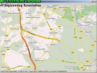
| بند انگشتی, برای دیدن عکس به صورت کامل بر روی آن کلیک نمایید |
|
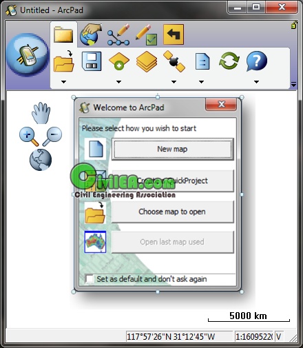
| بند انگشتی, برای دیدن عکس به صورت کامل بر روی آن کلیک نمایید |
 |
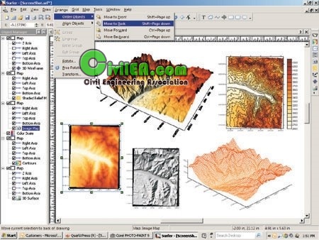
| بند انگشتی, برای دیدن عکس به صورت کامل بر روی آن کلیک نمایید |
 |
| بند انگشتی, برای دیدن عکس به صورت کامل بر روی آن کلیک نمایید |
There has never been a more comprehensive, powerful, all-in-one software solution that provides an easy-to-use and intuitive user interface for digitizing, geographic referencing, reprojection, tiling, and mosaicking. Didger solves the problem of combining data files in different coordinate systems, by providing extensive tools to transform the data into one cohesive coordinate system. You can use Didger to precisely convert paper maps, graphs, aerial photographs, or any other plotted information into a versatile digital format that you can use with other software. Didger can create new maps from the ground up or edit any map, drawing, image, or data set imported into it.
Didger is a highly accurate digitizing program that will be an invaluable addition to your software library. In seconds, Didger precisely transforms points, lines, or areas from your paper maps, graphs, aerial photos, scanned raster images, imported vector files, or GeoTIFF images to a versatile digital format you can use with your other software. You name it and Didger can handle it quickly, accurately, and usefully. With Didger's multitude of features and ease-of-use, this is an unbelievable value, considering the time and effort you will save!! You will soon wonder how you have done your job without this indispensable tool.
What's New in Didger 4?
We have compiled a list of the top new features in Didger 4. This list is only a small sampling of the new features added to Didger 4.
One Project Type!
Import all your data and perform all the functions necessary in one easy-to-use project. Didger has been streamlined so you can do all your work in one project type without the need for tedious exporting and importing!
User Interface Enhancements!
Didger has been redesigned to make it even easier and faster to use! Changes in properties can be seen immediately on the screen after they are made, you can change the visibility of individual objects with the click of a button, and the enhanced Layer Manager allows all options to be quickly accessible. You can customize the toolbars and menus, and choose from 6 different application appearances!
Automatically Vectorize Your Image!
Save time and headaches by letting Didger do your meticulous polyline and polygon digitizing! With just a few clicks, Didger will accurately and effortlessly digitize your image for you.
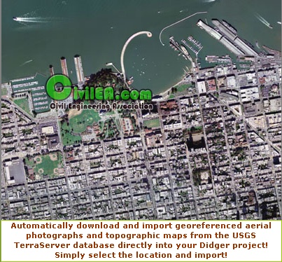
Free USGS TerraServer Topo Map and Aerial Photograph Imagery!
Didger 4 includes the astounding ability to link directly to the USGS TerraServer database and download satellite imagery and topographic maps of the United States free of charge! Simply select the area of interest and the images are imported directly into your project and automatically georeferenced!
New Versatile Image Calibration!
There are more ways than ever to import and calibrate your images. Calibrate an image either by entering coordinates manually or by simply clicking on points in your existing project! Alternatively, you can import the image un-referenced so you can move it around your project with your mouse! Your images have never looked so good!
Large Image Handling and MrSID Compatibility!
Didger 4 contains the most sophisticated and advanced image handling routines so you do not run out of memory when working with large image files! Importing multiple images and creating large mosaics and coverages is a snap. You even have the option to directly import MrSID files, making it even easier to work with large images!
Wrapped Polylines for Digitzing Well Logs!
Digitize your entire well log in one step, including the wrapped portions! Didger gives you the power to digitize logs that have curves off scale!
More Attributes for Your Data!
Import and export all of your data! Didger now supports up to 256 data attributes per object to give you even more control of your data.
Surfer Compatibility!
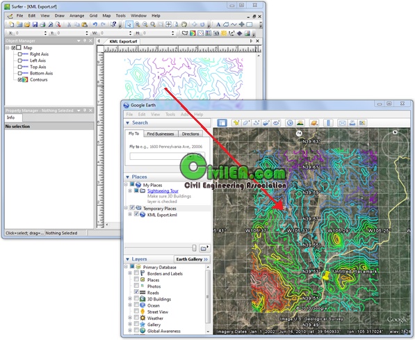
Now it is easy to see your maps the way you want them! Automatically digitize contour or other 3D data in Didger and send them directly into Surfer with a click of a button to change contour properties, overlay with 3D terrain surfaces, DEM files, or other 3D imagery. Didger also makes it easy to directly convert the projection Surfer GRD or DEM files, so you can have all your maps in the same coordinate system in Surfer!
Easily and Consistently Format All Objects On A Layer!
Set the drawing properties in any layer to be based on a keyword or numeric range found in one of your ID fields! Now you do not have to go through the time consuming process of repeatedly selecting or creating certain objects and assigning the same properties to them. It has never been this easy to create consistent looking projects!
New Fill Patterns and Line Styles!
Create your project exactly the way you want! Fill areas with one of the new picture or USGS fill patterns, use one of the many new line styles.
Convert a Polyline to a Polygon with a Shared Border!
Easily create a polygon with a shared border! Simply draw the first polygon, then use a polyline to define the next polygon. Use the “Polyline to a Polygon with Shared Border” command to convert the polyline to a second polygon! The shared border will be automatically created.
Additional New Features
Import/Export
• Import/Export 3D DXF files
• Import LAS files
• Import grid files (DEM, DTED, GRD, HDR) as point data
• Import MrSID and ECW
• Export multi-line LAS files
• Export in HTM format with working hyperlinks
Export in PDF format
• Export projected data in Lat/Long units
• Specify DPI of exported GeoTIFFs
Image Options
• Extract Image Region retains georeferencing
• Replace pixel colors on an image
• Resize an imported image
• Mosaic images into a single image
• New image processing techniques (Edge Detection, Image Thinning, Image Erosion and Dilation)
• Reduce the number of colors in an image
• Convert an image to black and white
Tools
• Create Intersection Points
• Convex Hull
• Divide Polygons
• Difference of Polygons
• Convert a set of points to a polyline, and vice versa
New Object Type
• Spline polylines
• Spline polygons
Editing Options
• Assign elevations to a range of polyline objects
• Set attributes by assigning new data attributes by selecting the objects
• Block select
• Rotate vector and text objects
• Align functions
Calibration/Projections
• Save and load calibration points to/from a data file
• Save and load projection settings to/from a GSR file
• New projections and datums
Other Enhancements
• Zoom and scroll the plot window while digitizing
• The Coordinate Conversion dialog has some new capabilities to define a new destination coordinate system
• Improved selection handling
• Select from a list a different digitizing cursor shapes and colors
• Enhanced graticule and grid settings
And many more!
Tips
- Manufactured by: Golden Software, Inc. Years: 1995-2009
- SO: Windows 2000, XP or higher, Windows Vista (for best results, run the program as administrator)
- 512MB RAM minimum for simple data sets, 1GB RAM recommended
- At least 100MB free hard disk space
- 1024x768x16-bit color minimum monitor resolution
- Product Tutorials available in each program - Go to Help | Tutorial within Didger.
- Language: english
- The most recent version of Didger is 4.4.2986 (06.02.2011)
- file. RAR contains: install version 4.0.2136 + Update v4.3.2740 + Patch install for v4.4.2986
 http://www.goldensoftware.com/produc...er/didger.shtm
http://www.rockware.com/product/overview.php?id=87
http://www.goldensoftware.com/produc...er/didger.shtm
http://www.rockware.com/product/overview.php?id=87
Download
http://www.mediafire.com/?tqh5a5c0h10n0tl
Password:
www.CiviLEA.com-201147


 پاسخ با نقل قول
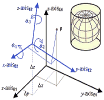


علاقه مندی ها (Bookmarks)